Data service system and equipment for ground and structure inspection
which is a technique for inspecting and analyzing changes from satellite data,
including
installation of equipment on structures and buildings
CDG Motion has 2 types of
products
According to the suitability of the work site
01
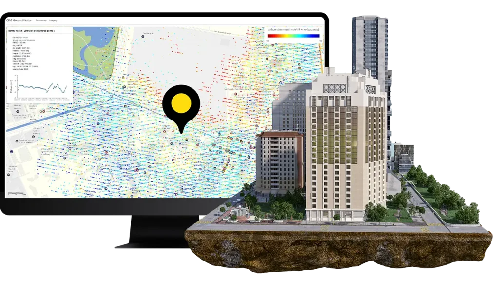
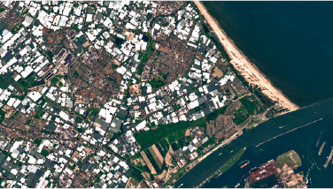
Ground Motion using
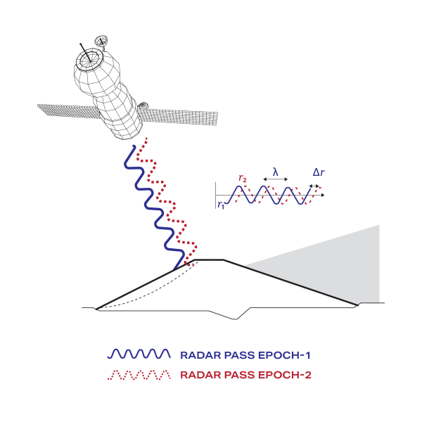
InSAR
Intererometric SAR(InSAR) satellite data processing
technology that can be used
to analyze
and inspect changes in the ground and large structures
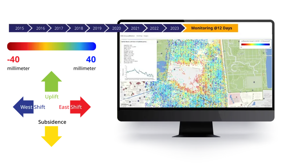
which will show results according to the specified time period or calculate
back up to 8 years
to view the movement history
Technology for monitoring the movement of the earth
and buildings with the processing technique “SAR
Interferometry” or “InSAR”
that will use data from satellites to measure changes in the surface
of the structure at different times
and display them as a graph
showing the rate of movement of the earth or buildings in units of
millimeters to monitor the subsidence of the ground or the
possibility of subsidence
in a grid area with a resolution of more than 6 x 12
meters
which will lead to engineering measures for safety
and sustainability of services to the public
or in the case of private buildings
can be used to assess the risk value of assets
for use or market value for insurance
Infrastructure safety monitoring, such as road networks, railways, expressways, or
even large constructions such as tunnels, buildings, etc. Ground Motion
using InSAR is a tool that helps enhance the efficiency of planning, inspection,
tracking
and prevention of risks caused by changes in the structure.
Which has been applied in many types, such as structural movement analysis
Impact on large-scale construction and public safety.
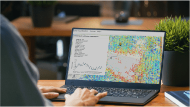
All data will be displayed through the Ground Motion Service, which can process data
Summarize historical movement data in the past for up to 8 years.
It can be applied during construction and during the opening of the area.
Which will update the movement of the area every 12 days.
It can also be easily set the time period to receive information.
And when there is abnormal movement, the Ground Motion Service system will notify
via Email,
LINE or others as needed.
Ground Motion using InSAR
Who is it suitable for?
Engineers and project
planners
Use data to analyze the area
and design the structure of buildings, roads or large
infrastructure
Designing construction to be suitable for the geological
conditions
Helps to enhance construction safety, withstand earthquakes
or possible earth movement
including the impact of the weakening of the surrounding soil of
the construction
Researchers and
statisticians
Used in case studies of land movement
Identification of geological risks
Surface land movement and other geographic conditions
Resource Planner and
Allocator
Used in natural resource management
planning
and risk prevention from earthquakes, ground movement
such as forest management planning, water management, reservoir
construction,
dams and land management
Project Manager
Use Ground
Motion data in project planning and management
to increase safety
reduce risk in project management to be more efficient
Actuarial
mathematician
Use data to plan and create strategies
Emergency risk management to make accurate decisions, such as
Insurance businesses that need data to assess risks
Collapse prevention or to support claims
02
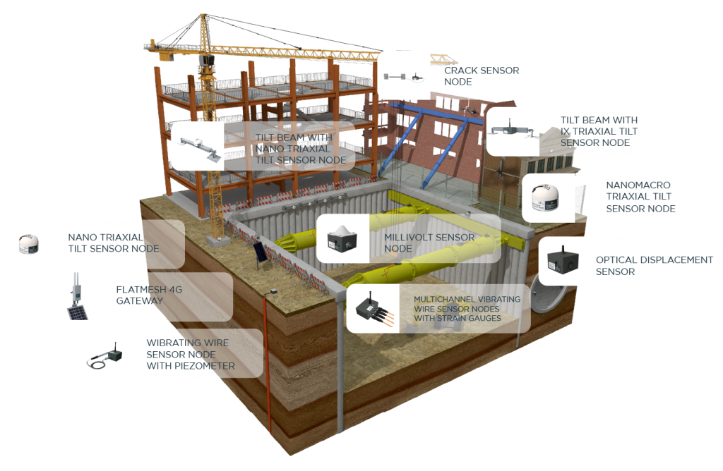
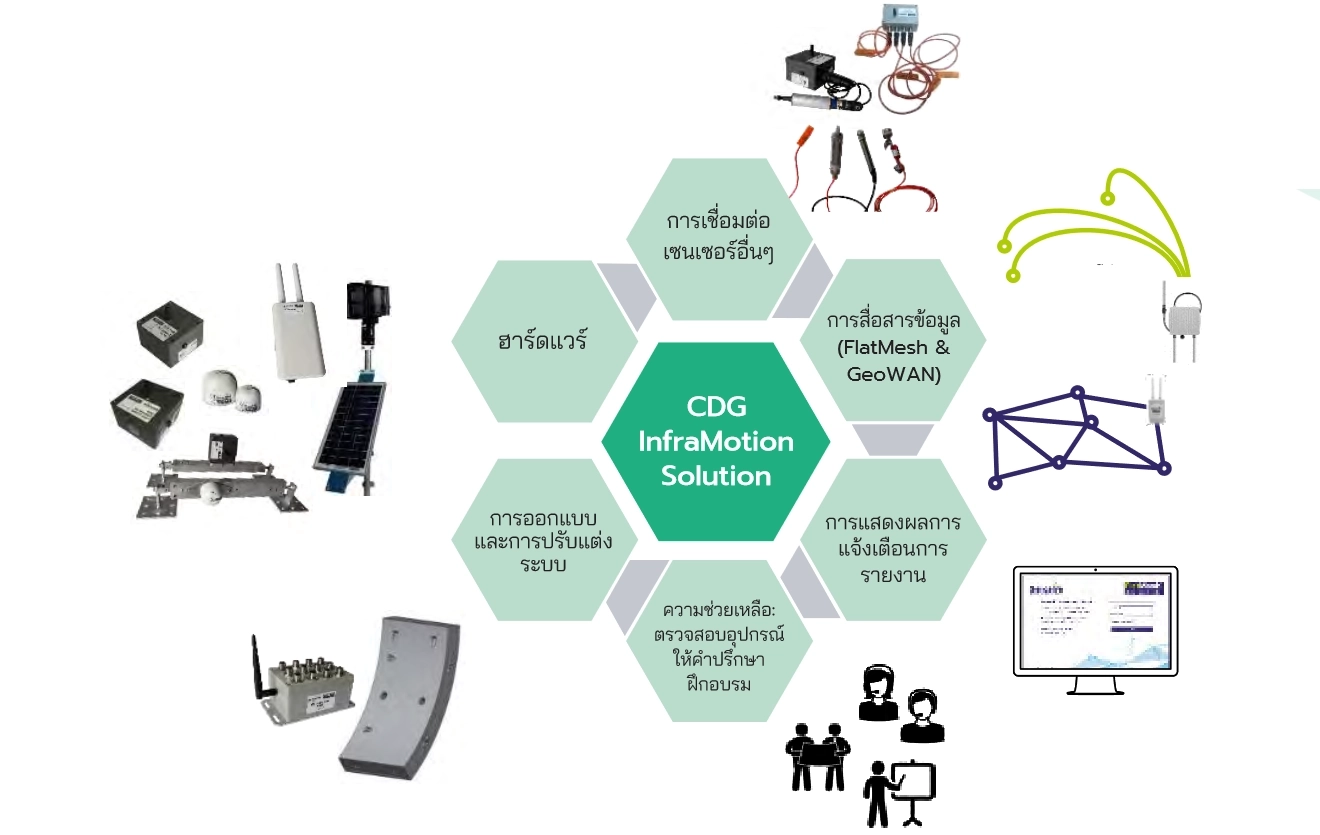
Infra Motion (IOT)
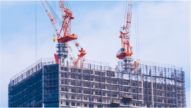
The equipment set for measuring the movement of structures and buildings can be
applied during construction.
For maximum data accuracy
Why InfraMotion? (IoT)
With our InfraMotion technology, it will help increase the safety of
construction and monitor the project's structures.
It can reduce the need for personnel to monitor the work site.
The inspection and results can be done immediately.
It can prevent possible damage.
It helps save both costs, personnel and construction.
InfraMotion is considered a wireless condition monitoring system
(Wireless Condition Monitoring – WCM). The measurement is highly
accurate.
The equipment is durable, low power consumption and the software
system is easy to use.
The results can be viewed online.
Therefore, it is suitable for geotechnical missions and structural
monitoring.
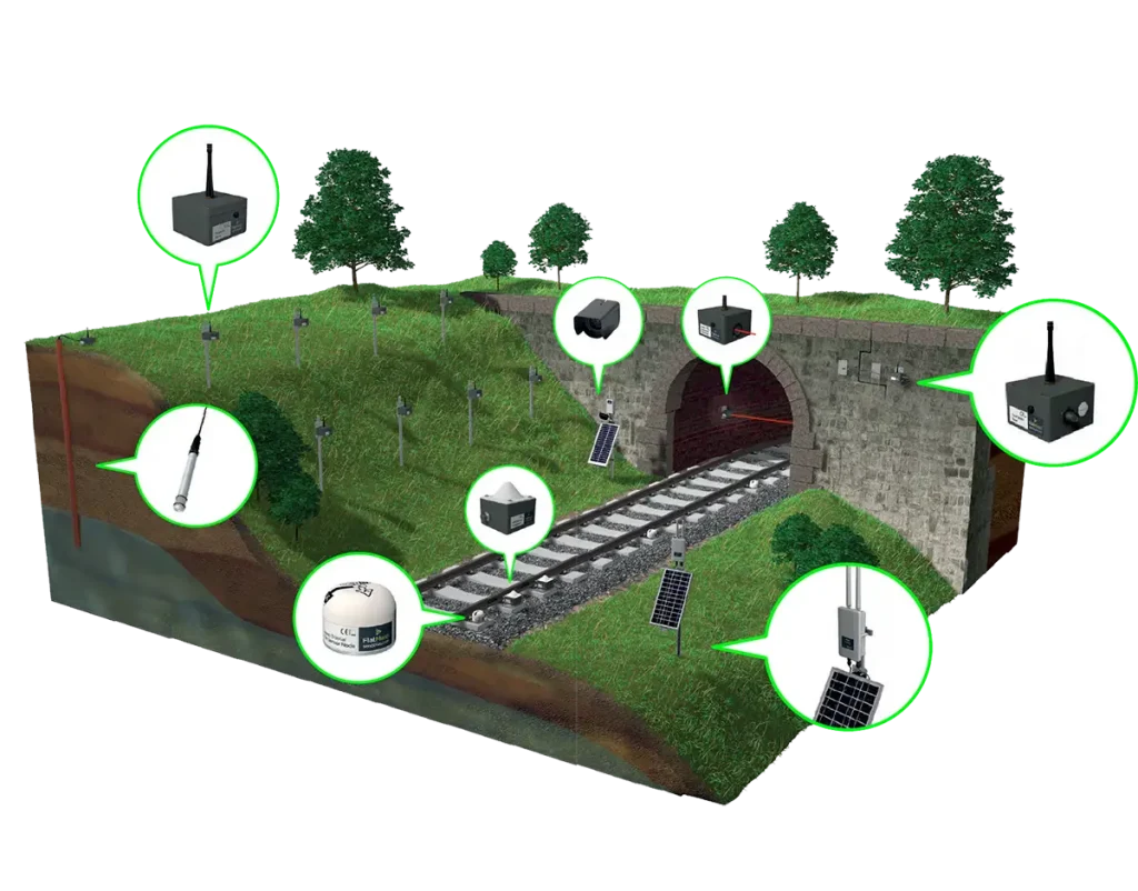
Automatic structural and building monitoring
Structural monitoring, such as rail systems to detect abnormalities during use
or to monitor potential damage in advance Bridge systems, excavation work
Tunnel drilling, building construction, which the integrated wireless monitoring
system InfraMotion
consists of
Integrated monitoring and tracking system solutions for construction
and geotechnical works
“Senceive” sensors have been continuously developed for over 20
years.
The system has been tested and used in real-world applications based
on user needs.
And our solutions can be applied in a variety of ways.
Through the use of a variety of scenarios and buildings
It is used during the construction phase until the building is
Opened with a variety of applications, making us the first choice
for
Applications
Piezometer Sensor detects the state of
or underground water pressure
IX-Triaxial-Tilt Node Tilt sensor
NANO-Triaxial-Tilt Node 3-axis nano tilt sensor
Millivolt Node External power sensor
Crack Sensor Crack sensor
Optical Distan Senser Visual distance sensor
Temperature Sensor Temperature sensor
4G Camera Solar powered camera
4G Gateway FlatMesh system via 4G gateway
Usage characteristics
Track Inspection
Work To observe changes in track
geometry, especially bending, twisting, lifting or subsidence.
Earthwork inspection and
monitoring work
Or
cliffs are early warnings for
landslides/falls
or changes occurring on general slopes
Bridge structure monitoring
work Monitoring the condition of the
structure
or behavior during limited, critical or special periods
including monitoring throughout the usage
Tunnel monitoring
work to know the status of
the geological structure
by integrating the structural work and movement during construction
during the repair period
or during normal use
Construction monitoring of
buildings to minimize risks
is a complement to safety measures
by using sensors that are installed in a way that is not noticeable
during the use of the building.
Ask for details or consult us.
If you want us to present more, leave your information so that we can present
The right solution for your business