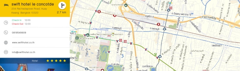
Searching
potential area to re-create better business strategy.
Hone your competitive edge and transform the way you view your
business with our wide range of tools
Spatial
Analytic Tool
Spatial analytics
Adaptable For
Business Planning
Business-oriented data adaptability.
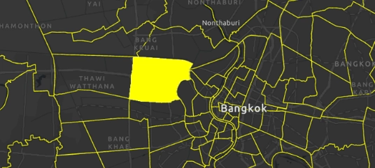
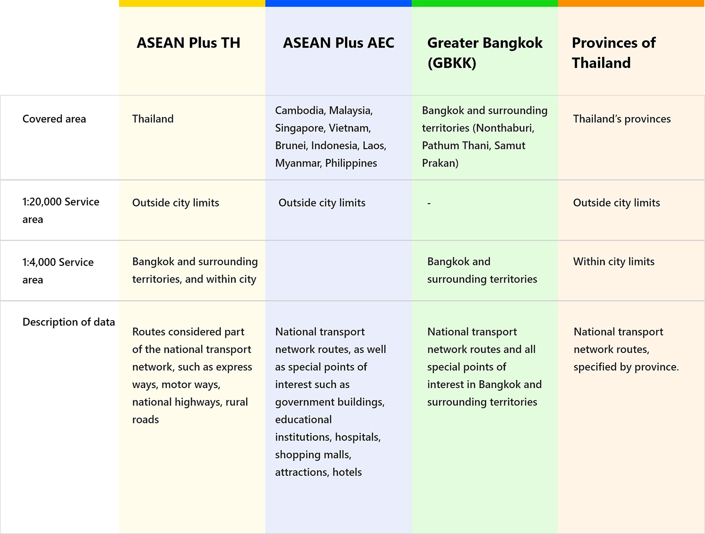
Best Coverage
Map In ASEAN
The greatest coverage of any mapping service in the ASEAN region
Easy To Use
For GIS Software
Built from the ground up for GIS software integration
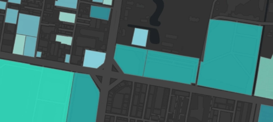
Customizable
Map
Highly customizable map features
Best Support
Service
Industry-leading support services
MapFusion GeoData
High-resolution, accurate digital map data covering the ASEAN region
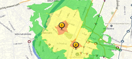
Our digital map utilizes vector data for the highest precision possible, usable with
GIS site analysis technology that can be used to better manage your business by
supplementing your marketing strategies, aid in the opening of new branches,
analysis of competing business service areas, and more.
Map Layers & Attributes
Our 10 standard layers of geographic data:
Administrative boundary Data layer
(Country/province/district/sub-district/water boundaries)
Municipal boundary Data layer (city municipality/city
municipality/sub-district municipality)
Road specification Data layer (Information of road name / type
of road / width and number of road lanes)
Road type Data layer (road/alley/lane (lane)/vehicle
route/private way/bridge/tunnel/entrance-exit/unpaved
way/village way/ferry boat/passenger ferry/sidewalk)
Intersection Data layer (Roundabout/three road
intersections/intersections/five-way intersections/intersections
of more than 5 roads)
Railway Data layer (Name of station/railway route)
Mass Transit System Data Layer (BTS/ MRT/ APL/ BRT covering
Bangkok metropolitan areas)
Water resource Data layer (Information on rivers/ canals/ lakes
and agricultural ponds)
National Park Boundary Data Layer (boundaries of national parks/
national parks/ wildlife sanctuaries)
Specialized Data Layer consisting of 7 million points of
interest throughout Thailand, consisting of 48 major categories
and 500 sub-categories (such as government offices/ shops/
tourist attractions/ restaurants/ accommodations/ factories,
etc.).
21 additional (Specialized) layers of geographic
data
Postal area boundary Data layer
Police area boundary Data layer
Village location Data layer (According to the Ministry of
Interior)
Bus stop location Data layer (in Bangkok and surrounding
territories and major cities such as Khon Kaen, Udon Thani,
Chiang Mai, etc.)
Kilometer marker Data layer
City plan Data layer (shows each area’s land usage according to
city planning law)
Land expropriation Data layer (According to the announcement of
the Royal Decree)
Aviation safety zone Data layer
Noise pollution Data layer of Suvarnabhumi Airport
Future Data layer (includes information on projects currently
being planned for future implementation, such as: electric train
routes, intercity motorways, attractions, villages,
condominiums, etc., that are under construction)
Street food Data layer (divided into 2 types: food truck/ hawker
stalls across the country)
Subdistrict Administrative Organization (SAO) boundary Data
layer
Building boundary Data Layer
Intersection Data layer
Electric vehicle charging point Data layer
Flood zone Data layer
Real estate zone/area Data layer
Primary/secondary entry point Data layer
National forest area Data layer
Provincial town plan Data layer
TSIC-based business type classification Data layer
Special feature We also provide additional features that can be used
atop our map data solutions for further efficiency and efficacy
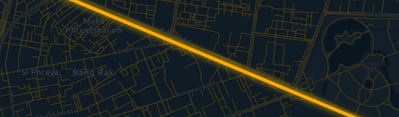
Network data set calculations of the amount of
time and distance it takes for deliveries, supporting up to 5
modes of transportation (Car/ Motorcycle/ Bicycle/ Truck/
Pedestrian). This helps you find the best route based on
shortest distance or shortest amount of travel time. Also
includes data enabling searching for the closest facilities, or
the boundaries of specific services.
3D Model provides realistic 3D renders of
buildings
Indoor map provides indoor mapping
data
Indoor Navigation provides the ability to
calculate time, distance, and routes of indoor locations
Complex map supports GIS software with data on
public parks, markets, universities, convention centers, and
more in Bangkok
Population provides highly accurate estimates
of population density for use in business planning, whether for
business expansion, analysis, market research, or otherwise, to
increase efficiency and efficacy.
Special Fields consists of additional data atop of our standard data
layers for even further accuracy and reliability.
Road data layer
o Road dimensions (in relation to the average road
height in the given area)
o Surface data
Point of interest data
o Address – house number, or plot (mu/moo/M)
o Phone and/or fax number
Neighborhood data
o Neighborhood population data
Extra content additional specific data of various locations such as
operating hours, pricing information, establishment type, number of
branches, and others
บริการประสานงานชุมชน Community
Services
Coordinator
ร้านหนังสือ Bookstore
ร้านก่อสร้างและตกแต่ง Shop
construction
and
decoration
สถานบันเทิง Entertainment
venue
ที่จอดรถ Car
park
โรงงาน Factory
บริการซ่อม Repair
Service
สหกรณ์ Cooperative
เกษตรกรรม Agriculture
โชว์รูมรถจักรยานยนต์ Motorcycle
showroom
สถานที่อื่นๆ Other
Thailand GIS DATA (Update
2025)
77
Provinces
928
Districts
7,436
Sub Districts
936,236
KM. on the road
2,194,043
POI
Our Package Plan
Consult with
our experts
Have a question, or don’t know where to begin? Send us your inquiry
today! Our team is readily available to provide help and support
wherever possible.